Wenas Maps
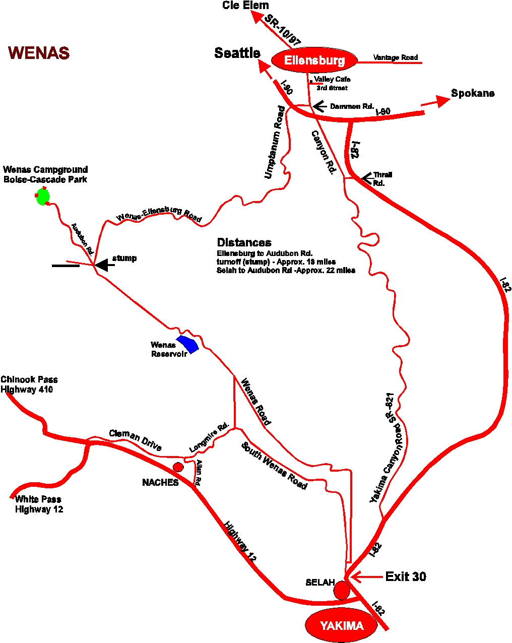
Driving Directions & Road Map
Upper Wenas Public Access
The Upper Wenas Owner’s Group met in October and agreed upon a protocol that will allow continued access to the
upper Wenas areas by all user groups (including hunters, horse backpackers, jeepers, bow hunters as well as Audubon) with
reasonable restrictions designed to protect the land and private owners’ interests. The restrictions include gates at BBQ Flats
property line, Audubon Road, and at Observatory Road and upper Observatory Road, to be closed December 1 to May 1.
In addition, by May a Green Dot road agreement will be in place identifying roads appropriate to drive on and those not.
The primary damage to private lands (which can result in a closure of all access) includes damage to roads in the wet
season, unauthorized campfires, muddying creeks, and destroying gates and fences.
Please drive slowly when going through the private property.
Please remember to Close Gates behind you.
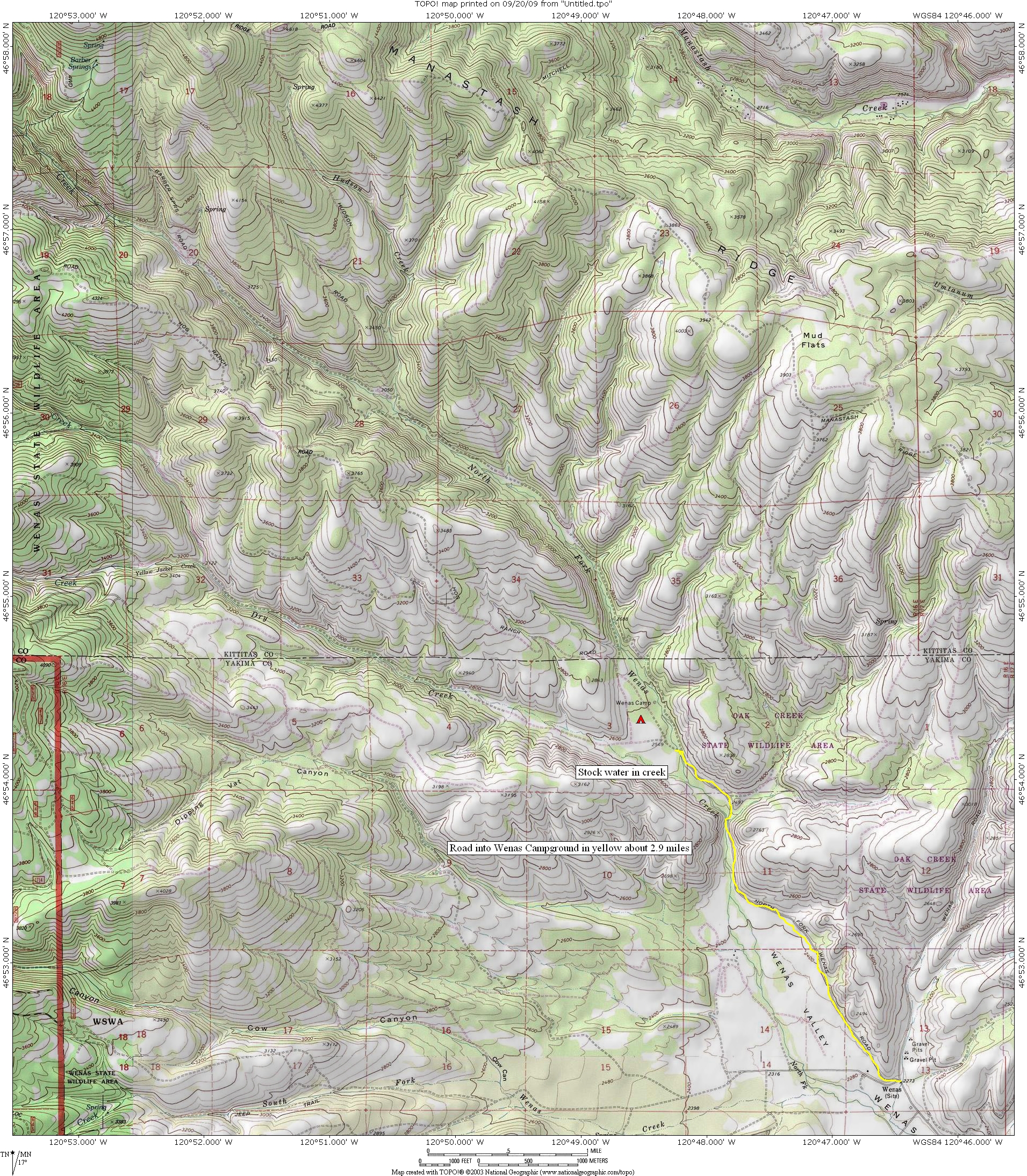
North side of Valley & Wenas Campground
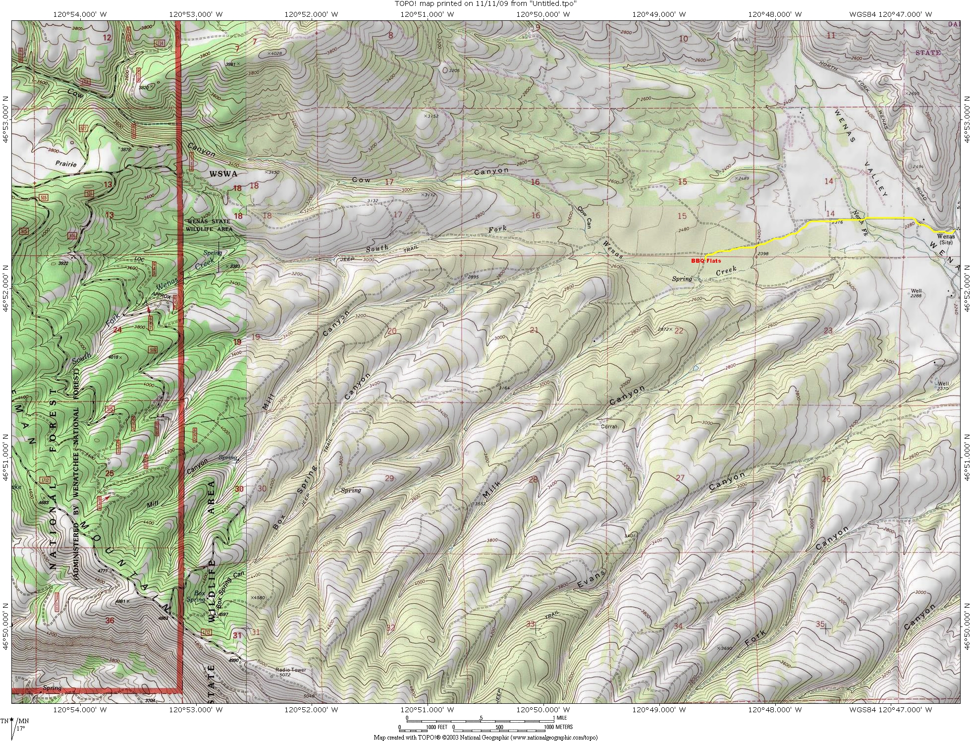
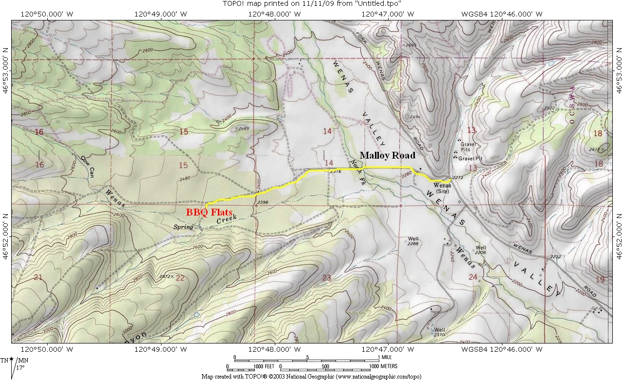
South side of Wenas Valley & BBQ Flats Campground
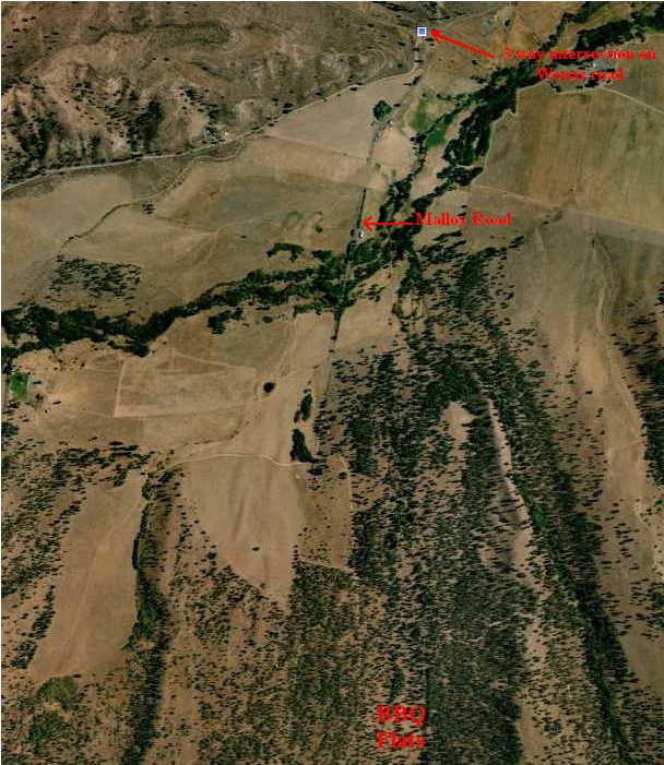
North Wenas Road and follow for ten miles (past Wenas Lake) to end of paved road/crossing cattle guard.
At three way intersection stay left on gravel Malloy road for three miles. Turn left after cattle guard and go through pole gate to Barbeque Flats (Close The Gate!).
Location Driving map
Aerial View
Area Topo Map